
Walk a Moses Lake Street Directory From Address to Record
A Moses Lake street directory search establishes parcels and public record links, not a complete list of occupants. Grant County PACS identifies recorded owners, situs and mailing addresses, parcel keys, legal descriptions, and sales leads. GIS shows how parcels meet the road and each other. Deeds confirm transfers. Voter and historical directory sources can add limited evidence of residency, but they contain lawful-use restrictions and gaps.
- Enter a full or partial street name in Grant County PACS, choose Moses Lake when useful, and page through every parcel result.
- Compare the same road segment in county or city GIS, click parcels, and copy each Property ID or Geo ID.
- Separate situs from mailing address and note association, government, utility, vacant, and other non-household owners.
- Search the current owner as a grantee in EagleWeb, inspect the transfer reference, then work backward through grantors.
- Use voter data only through the permitted state process, and consult directory or newspaper sources for earlier households.
This street-by-street method preserves the key distinction between titled ownership and current residence. It also creates a clear record trail that another researcher can check.
Record the date of each search. Assessment ownership, permit status, voter registration, and map layers can change on different schedules. A simple research sheet can keep one row per parcel with separate columns for situs, mail, owner, legal description, source date, and any later historical clue. That prevents a name found on one lot from drifting onto the next lot during a long street browse.
Run the Moses Lake Street Directory Through PACS
PACS accepts partial Street Name text, an optional Street Number, and a City selector. Leaving Owner Name blank makes a whole-street browse possible. Each useful result should be opened and checked for situs, owner, mailing address, Property ID, Geo ID, legal description, tax area, values, sales history, and a linked map. The current system covers 2024 forward; Grant County directs searches for 2010 through 2023 to its older TerraScan site.
| Search control | Street-directory use |
|---|---|
| Street Name | Full or partial street text; useful when suffix punctuation varies. |
| Street Number | Narrows to one address when the road result is long. |
| City | Filters by Moses Lake label, without proving incorporated jurisdiction. |
| Property ID / Geo ID | Returns a known parcel and bridges to GIS or permits. |
| Subdivision / Township / Range | Finds legal geography when a street label fails. |
| Map Search / Sales Search | Switches from text to spatial or transfer-oriented review. |
The official PACS search page is visible in the captured image below.
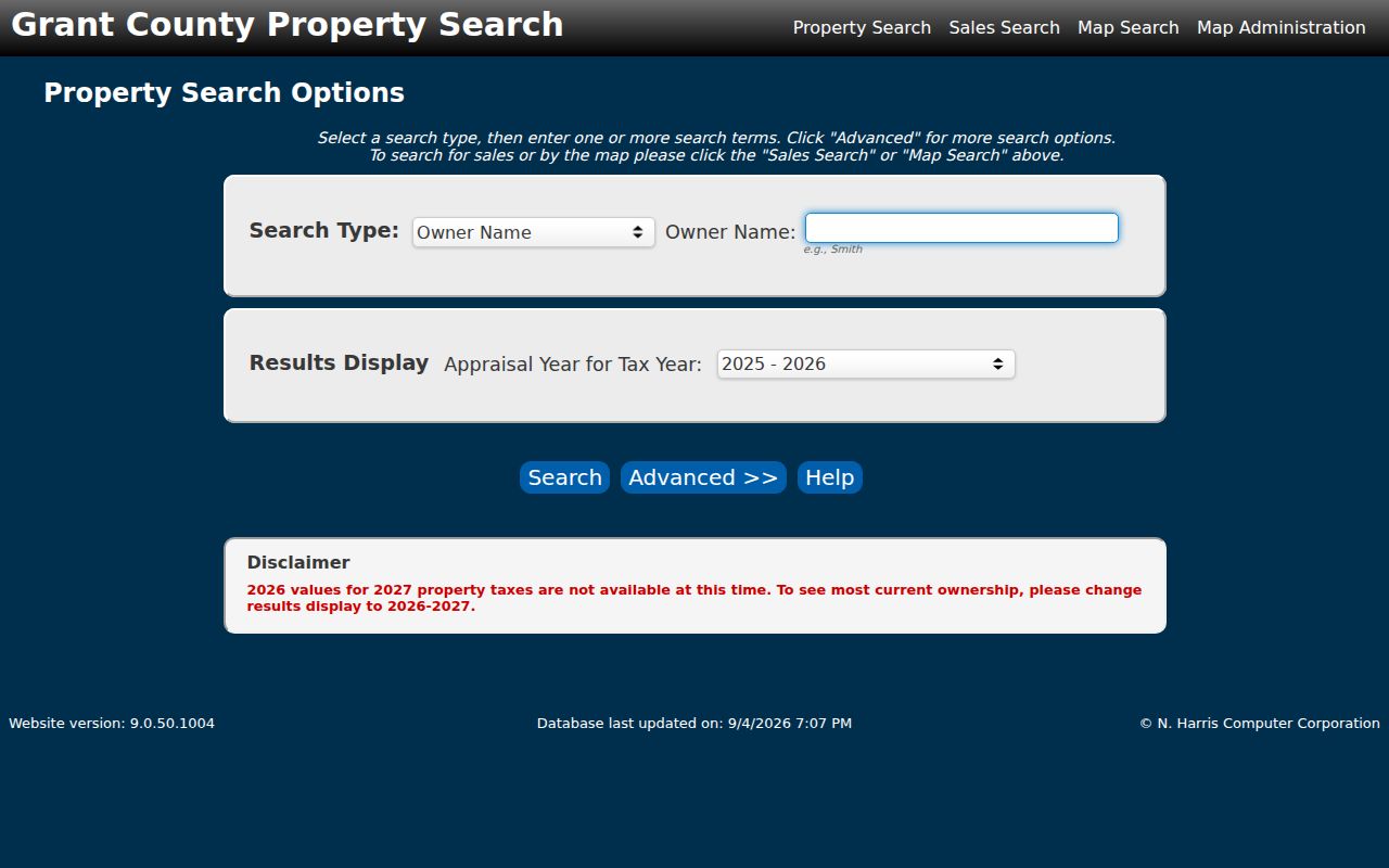
The live form is more precise than a free-text web search because each result is tied to a Grant County parcel record.
PACS also explains its parcel coding. The county describes a 6-6-4 structure in which the first six digits encode township, range, and section, the next six represent map coordinates, and the final four distinguish a more specific description. Quarter and quarter-quarter choices further narrow land within a section. These keys are especially helpful on rural edges where a road label is new, shortened, or recorded in another form.
Situs, Mail, and Title Mean Different Things in Moses Lake
The sampled PACS record shows why one address field is not enough. Its situs reads Moses Lake Rural, its tax mailing line is a Moses Lake post office box, and the owner is a community association rather than an occupant. Legal description and parcel key identify the land; neither the mailing city nor the association name proves who lives nearby.
- Parcel
- A legally described tract tracked by an assessor database key.
- Situs address
- The physical location assigned to the parcel.
- Mailing address
- The destination for tax mail, which may be a PO box or agent.
- Plat
- A recorded map that defines lots, blocks, roads, and common land.
- Criss-cross directory
- A historical directory arranged by address or phone.
Grant County also distinguishes incorporated streets from its predictable rural addressing grid. If the structure is far from the designated road or not visible, county rules require a road-side marker, and assigned numbers must be displayed within the stated posting period.
The legal description supplies continuity when the postal address does not. Lot, block, plat volume and page, subdivision, township, range, and section can survive a road-name change or address adjustment. Keep the old and new address forms together, but use the legal land key when asking Auditor Recording to locate an older instrument.
Map a Moses Lake Street Before Naming Its Owner
Open Moses Lake GIS and Mapping for city context or the Grant County GIS gallery for county layers. Zoom to the road, turn on parcel boundaries and available jurisdiction, zoning, flood, district, and planning layers, then click a parcel and carry its identifier back to PACS. Dynamic control names were not verified in the research, so do not assume a particular buffer or export button exists.
City maps are informational and their accuracy should be confirmed with Engineering/GIS. County GIS maintains unincorporated spatial data and site addresses. A street can cross a city line, canal, plat edge, or urban growth boundary, so the custodian for permits and addressing can change while the mailing city stays Moses Lake.
Note: A map proves parcel position and jurisdiction context, while the assessor and recorded deed identify the legal ownership trail.
Address-Keyed Records for a Moses Lake Street Directory
Several Moses Lake and Grant County systems accept an address or parcel, but each documents a different event. The street directory becomes dependable when a parcel identifier carries the search from map to roll, instrument, permit, and historical source.
| Record Set | Keeper | What It Shows | Access |
|---|---|---|---|
| Property and tax roll | Grant County Assessor | Owner, situs, mail, legal description, values, sales | PACS 2024-current; TerraScan 2010-2023 |
| Parcel maps | Grant County GIS / Moses Lake GIS | Geometry, roads, jurisdiction, planning layers | Public maps; verify map accuracy |
| Deeds, liens, plats | Grant County Auditor | Recorded parties and legal instruments | EagleWeb index; copies from Recording |
| Voter file | Secretary of State / County Elections | Defined public voter fields and address | Restricted request; protected omissions |
| Permits and code files | Moses Lake or Grant County | Site, parcel, work, dates, named parties | Portal, report, or targeted request |
The property roll is the hub. The legal description ties it to deeds, the parcel number ties it to maps and permits, and the road label ties it to address-based historical searches. No row should be read as an occupant list.
Access channels matter when a portal fails. GIS staff can help confirm a map or special-map request. The Auditor supplies copies that EagleWeb only indexes. City permit reports can supplement a live portal, and code records may require a focused city request. A library catalog or reference-desk inquiry replaces an unsupported claim that a reverse directory is on the shelf.
Follow the Auditor Trail Along a Moses Lake Street
PACS sales history is a lead, not proof of title. Note its sale date, document number, grantor, grantee, price, recording number, and volume or page, then open the Grant County EagleWeb index. Search the current owner as grantee, identify the seller, request or inspect the deed, and repeat with the seller as an earlier grantee.
Legal descriptions matter when an address changes, a lot splits, or a road crosses more than one plat. The online starting year is not published. When a result or image is unavailable, call Auditor Recording at 509-754-2011 ext. 2705. The office provides recorded-document copies and can explain older books, microfilm, and current search or copy charges.
Quitclaim deeds, trusts, estates, boundary adjustments, and common-area transfers can interrupt a simple buyer-to-seller sequence. When names stop lining up, return to the instrument type and full legal description. A transfer price or assessor sales row may also reflect circumstances that the short index cannot explain. The recorded document, not a guessed relationship between parties, controls the next step.
The EagleWeb capture shows the official recorded-document entry point for a Moses Lake street directory.
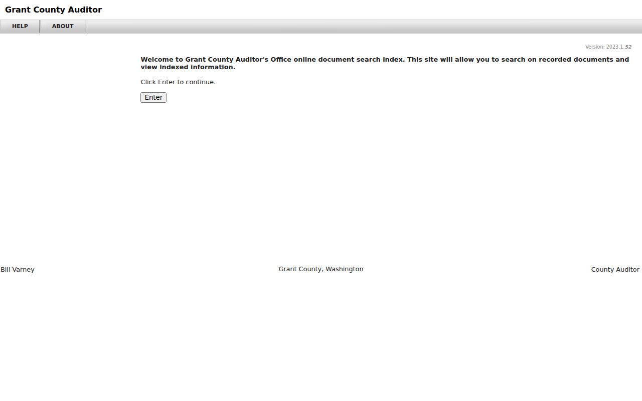
The recorded instrument should be matched back to the same parcel or legal description before a similar owner name is accepted.
Permits Date Work on a Moses Lake Address
City Permit Services and the county SmartGov center create an address-keyed layer that property and deed records do not supply. A city permit report can show permit number, site address, parcel, valuation, type, work description, owner, contractor, and issue date. Those facts date work at the property, but a contractor or applicant is not necessarily a resident.
Inside the city, use the Moses Lake permit portal or monthly Building Permit Reports and ask Community Development when the portal cannot answer. Outside city limits, use the Grant County Online Permit Center. County building and fire submissions moved to electronic-only intake on June 16, 2025, except the documented small-accessory-structure exception, and incomplete submissions expire after ten business days.
Code Enforcement does not have a verified public case index. A targeted city request should name the address, date range, case number if known, and record type.
County and city portals are also split by jurisdiction. Before filing, use the parcel map and city limit or UGA context to choose the office. If the road crosses the boundary, submit each parcel only to the keeper likely to hold its permits. That is faster and more accurate than treating the full road as one city project.
Moses Lake Rural Addresses Change the Custodian
The 98837 delivery area extends beyond incorporated Moses Lake. The city-limit and urban growth area map, parcel jurisdiction, and PACS tax area should be checked before requesting a record. City Hall handles city permits and addresses; Grant County GIS and Site Addressing handle the unincorporated grid. A Moses Lake Rural label is therefore a routing clue, not a neighborhood name that proves occupancy.
The city map also labels Broadway, Division, Third, Pioneer, Nelson, Yonezawa, Wheeler, Harris, Stratford, Baseline, Westshore, and numbered rural roads. Annexation and boundary changes can leave one road with city and county record custodians. The active 2027 Comprehensive Plan update adds timely planning context, but it does not alter a recorded parcel by itself.
Note: Verify the city or county boundary on the date relevant to the permit or address record, not only on today's map.
A Voter File Is Not a Moses Lake Street Directory
Washington's public voter fields can include name, address, jurisdiction, gender, year of birth, voting history, registration date, and registration number. The bulk VRDB route requires requester details, county and file selection, and agreement to RCW 29A.08.720 and related restrictions. It is updated monthly and an approved request can take up to five business days.
VoteWA is an individual self-lookup, not a tool for browsing every home on a road. The voter file omits nonvoters, does not carry party preference because Washington does not register by party, and withholds Address Confidentiality Program and protected-voter records. Advertising and solicitation use is forbidden. Those limits make the data incomplete even when the request itself is lawful.
Search Neppel When a Moses Lake Street Vanishes
Moses Lake was first platted as Neppel in 1911 and took its current name when incorporated in 1938. An older household can appear under Neppel, a precinct, a township and section, a lot and block, or an earlier road form. No verified formal citywide street-renumbering year was found, so a precise year should not be invented.
Cataloged local directory and telephone material is scattered across institutions, with leads from 1957 and 1959, a 1965 Polk title, and selected telephone or business volumes from 1963 through 2002. Address-arranged sections may work like a criss-cross directory, but the exact Moses Lake reverse run is not confirmed. The Moses Lake city directories collection gives the historical shelf method without repeating it here.
Newspaper microfilm fills some gaps: the Columbia Basin Herald runs from July 1941 through July 2015 at the Moses Lake library, while the Grant County Journal run is at Ephrata.
When the street section is absent, search a surname, spouse, occupation, phone number, or business listing, then work back to the address. Pair the result with a census year, newspaper item, deed, or permit. Directory years are snapshots and the cataloged runs are irregular, so an empty year does not prove that the household was gone.
Where the Moses Lake Street Directory Must Stop
A public street directory cannot list every person inside a home. Property records omit unlisted occupants and can name an absentee owner, trust, business, government body, or association. Tax mail may go to a PO box or agent. Utility customer lists are not a public resident roll, DMV address data is restricted, and sealed court or vital material stays outside a general search.
Commercial compilations can merge stale owners, unrelated household members, and people with the same name. Use them only as unverified leads, then return to the assessor, recorded instrument, official court file, or historical collection. Personal safety and civic curiosity do not justify evading a protected address or contacting someone who has not invited contact.
Some omissions are required by law or by the design of the source. Address Confidentiality Program participants and protected voter records do not appear in ordinary voter data. Participant addresses and minors' birth dates are not public through court reference systems. Military discharge instruments may carry special limits even though recording offices handle that record family. An empty public result can therefore mean protected, sealed, not indexed, outside the date range, or held by another office. It does not prove that no record or person exists.
A careful street directory also avoids drawing social conclusions from physical proximity. Two parcels that share a boundary may be divided by a canal, alley, access strip, or common tract. A named owner may be an association responsible for parks or roads. Map the relationship first, label the source, and describe only what the public record actually shows.
For a correction or older file, contact the keeper with the parcel key, legal description, road form, and date range. The Assessor handles roll facts, Auditor Recording handles instruments, GIS handles mapped context, and the city or county permit office handles work records. Keeping those roles separate makes the final result easier to verify.
Lawful use. Moses Lake address records support lawful personal, family-history, property, and civic research. Washington law prohibits harassment, and no directory result permits stalking, intimidation, or harm.