
Moses Lake Neighbor Sources
A useful Moses Lake neighbor search combines several official sources. Grant County GIS supplies the shape and location of each lot. The county property roll, called PACS, connects that parcel to its legal owner, tax-mail address, situs address, and legal description. EagleWeb adds recorded transfers. City or county permit records may document work at an address. None of these records is a census of the people inside a home, so the source must match the question.
| Source | What It Shows About a Block | Access |
|---|---|---|
| Grant County GIS | Touching parcels, roads, districts, boundaries, and available planning layers | Public dynamic maps; special maps by records request |
| Grant County PACS | Owner, mailing and situs addresses, legal description, tax area, and sales history | Free parcel-by-parcel web search |
| EagleWeb | Recorded transfers and the legal descriptions tying deeds to nearby lots | Public index; copies from Auditor Recording |
| Washington voter file | Defined public voter, address, precinct, and participation fields | Formal extract request with statutory limits |
| Local associations | Public board, event, member-business, and community contact details | Organization websites; no universal household roster |
Ownership is not occupancy. A person, trust, company, public body, or homeowners association may own a parcel. Mail may go to a post office box or agent. A renter, relative, guest, or other resident may never appear on the tax roll. Treat the owner name as a documented property link, not proof of who sleeps at the address.
Check Each Moses Lake Parcel
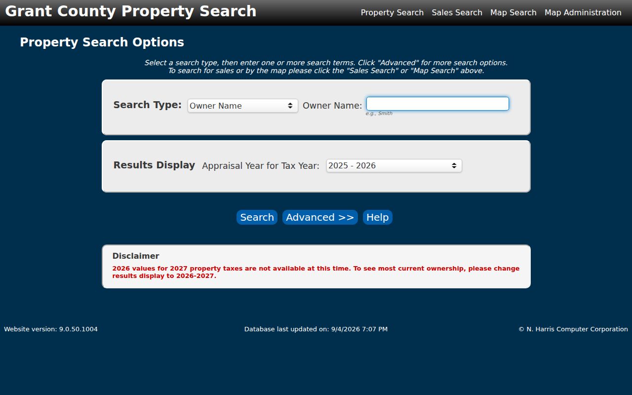
Once GIS supplies a parcel or Geo ID, open Grant County Property Search. PACS accepts an owner name, street number, full or partial street name, city, Property ID, Geo ID, or doing-business-as name. Advanced choices include subdivision, township, range, section, appraisal year, and property type. Current county guidance assigns PACS to 2024 and later records, while the older TerraScan system covers 2010 through 2023.
The detail screen separates situs, which is the parcel location, from the address used for tax mail. It also provides the legal description, tax area, neighborhood code, values, improvements, and sales history where present. The sampled Pelican Point common-area parcel illustrates the distinction: an association owns land with a Moses Lake Rural situs while its mail goes to a Moses Lake post office box. That is an entity-owned common parcel, not a neighboring household.
The official PACS search screen shows the controls used to move from one address to the surrounding ownership records.
Use the same tax-year display for every parcel on the block. Mixed years can make a recent transfer look like a conflict when the records simply reflect different assessment periods.
Note: PACS ownership and mailing fields locate a legal owner, but they do not identify every person who lives on the parcel.
Moses Lake Block Map Layers
The Moses Lake GIS program and Grant County GIS gallery answer different parts of a block question. The city maps place parcels within city streets, zoning, and municipal boundaries. County mapping covers rural site addresses and broader district data. Both agencies warn that map data can change, so a parcel ID and legal description should back up a visual match.
Turn on parcel, road, zoning, floodplain, fire, school, election, land-use, and city-limit or urban-growth-area layers when available. A nearby lot may sit across an alley, canal, lake reach, road, plat line, or jurisdiction boundary. Those features explain why the nearest home is not always the parcel that shares a boundary. Save the parcel ID, layer names, and map date for each result.
- Parcel
- A mapped unit of land with its own county identifier.
- Situs
- The physical location assigned to a taxable parcel.
- Legal description
- Lot, block, plat, or land wording that controls when a street address changes.
- UGA
- The urban growth area around the city; it is not the same as incorporated city limits.
Map Moses Lake Neighbors
Define the block before collecting names. For a tight neighbor lookup, count parcels that share a boundary and parcels directly across the road. A wider radius needs a clear distance rule. Dynamic map controls vary, and the exact names of select or buffer tools were not verified, so the reliable method is to pan, zoom, click, and record each parcel individually.
- Find the known address in the city parcel lookup or county GIS. Confirm the road and city or county jurisdiction.
- Click the starting lot and copy its parcel or Geo ID. Then click each touching lot and the parcels directly across the road.
- Open every ID in PACS. Record owner, situs, mailing address, legal description, tax area, and linked parcels without treating mail as residence.
- Mark common areas, vacant tracts, utilities, churches, government parcels, and association land apart from household lots.
- Use EagleWeb only when a transfer or shared plat needs confirmation. Request the document copy from Grant County Auditor Recording.
This creates a repeatable trail: address to map, map to parcel ID, parcel ID to owner record, and owner record to deed when needed. For every parcel along a long named road, switch to the Moses Lake street directory method instead of widening a block search without limit.
Moses Lake Neighbor Boundaries
A Moses Lake postal label does not settle local jurisdiction. ZIP 98837 extends beyond the incorporated city, and PACS may label a situs “Moses Lake Rural.” Grant County assigns site addresses outside incorporated cities; City Hall handles addresses within city limits. Check the city-limit and UGA layers before sending a permit, code, or address request.
Water adds another wrinkle. Peninsula roads, west-shore developments, rural numbered roads, and parcels near the airport edge do not form neat square blocks. Roads such as Westshore, Stratford, Nelson, Wheeler, Yonezawa, Harris, and Baseline cross different settings shown on local maps. A parcel across the lake is visually near but is not an adjacent neighbor. A lot across a city boundary may use a different permit office even when both addresses say Moses Lake.
Geography tip. Verify the parcel, city-limit layer, and legal description before deciding whether Moses Lake or Grant County keeps an address record.
Moses Lake Voter Block Limits
Washington's registered-voter database can include name, address, political jurisdiction, gender, year of birth, voting record, registration date, and registration number. It does not record party preference. Full dates of birth, driver-license numbers, the last four digits of Social Security numbers, and registration-agency details are not public. A voter record can corroborate one registered residential address. It cannot show every adult, child, owner, or other person on a block.
The state voter-file request supplies active voter and district data as a monthly CSV after a requester provides identity and contact fields and agrees to the legal terms. RCW 29A.08.720 and related rules bar advertising and solicitation uses. The public VoteWA service is an individual self-service route, not a street household directory.
Address Confidentiality Program participants follow a protected-voter process. Their actual address, name, county, and precinct may be withheld. A missing public result therefore cannot prove that a person is unregistered or absent.
Cove West Neighbor Network
Cove West HOA describes a west-shore community developed in the mid-1980s with 92 homes or lots, one entrance, private parks, a boat launch, dock, sport court, cameras, an elected seven-member board, and an annual meeting in February or March. Every owner belongs to the association, but the public site does not publish a full directory of residents.
That distinction matters. The association is a verified way to learn about community rules, meetings, and shared facilities. PACS remains the source for recorded parcel owners. Neither source proves who is present in a home on a given day. For questions about a common tract, start with the association contact and then confirm the parcel owner and recorded plat.
Downtown Moses Lake Contacts
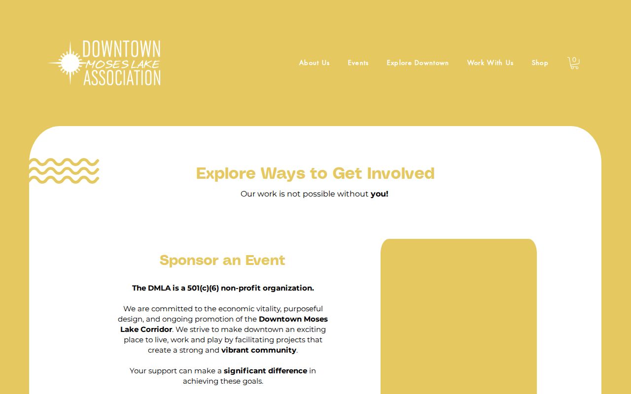
The Downtown Moses Lake Association offers another kind of local directory. It is funded through memberships, promotes downtown, lists public events and current members, and provides an organization contact. It is a civic and business network, not a roll of all downtown residents.
The association's public page gives a useful view of its programs and contact route.
Use a listed member or event as a direct public contact lead. Do not infer that a business owner, board member, volunteer, or event participant lives on the same block.
Downtown Moses Lake Association
205 S Division
PO Box 1201
509-770-1700
director@downtownmoseslake.org
Cove West HOA
West-shore community contact through its official website. Public board and meeting details are available, but no complete resident list is posted.
Moses Lake Association Records
Public property and nonprofit records surface other local names, including Columbia Valley Estates HOA, Crystal Springs Place HOA, Desert Hills Homeowners Association, Diamond Point Owners' Association, Dove Haven Homeowners Association No. 1, and Pelican Point Community Association. These names are research leads, not a verified citywide federation or member directory.
Confirm an organization through the Washington Corporations and Charities Filing System, PACS ownership records, and recorded declarations in EagleWeb. A filing may identify an entity, registered agent, address, officers, or governors when included. It still does not establish which people live in the subdivision. Churches, service clubs, veterans groups, and block-watch programs work the same way: public meeting and contact details may be used, but no private roster should be sought or republished.
Official Moses Lake Neighbor Records
Commercial neighbor tools often merge public property data with marketing files, old directories, and user-supplied material. A stale owner or same-name match can be shown as a present resident. Official sources are narrower, but each field has a known custodian and meaning.
| Source type | Best use | Main limit |
|---|---|---|
| GIS and PACS | Map parcels and identify recorded owners | Ownership does not prove occupancy |
| Voter records | Confirm defined public registration fields | Restricted use and protected omissions |
| Community groups | Find public events, boards, and contact routes | Membership does not prove residence |
| Commercial compilations | Broad lead gathering | Source dates and identity matches may be unclear |
For a lawful neighborhood question, prefer parcel maps, custodian records, and voluntary public contacts. Verify a name before making contact, and do not publish a compiled block list.
Moses Lake Neighbor Privacy
Public parcel records do not disclose unlisted occupants, guests, or every household member. Utility and delivery customer data, ordinary motor-vehicle addresses, sealed court material, protected vital records, and phone or email details are not general block directories. Owners may also be trusts, companies, associations, or people who live elsewhere.
Washington's Address Confidentiality Program gives eligible survivors and certain threatened workers a substitute address and mail-forwarding service. Protected voter records keep the actual home details out of public view. Old records created before enrollment may remain, but that is no reason to combine and republish them. Direct safety concerns to law enforcement or the proper court process, not a wider search for private data.
Lawful use. Moses Lake neighbor records may support civic contact, property research, or personal safety awareness. Never use them to track, threaten, harass, or expose anyone.